Chiricahua: America’s 64th National Park — and entry is free

On October 20, 2026, the United States gained a new national park. Chiricahua, in southeastern Arizona, went from national monument to national park after 102 years under its old title. It is the country’s 64th national park, Arizona’s fourth after the Grand Canyon, Petrified Forest and Saguaro, and the first new one since New River Gorge in 2021. The law, passed unanimously in the Senate in September after a House vote in March, changes nothing about the boundaries: its roughly 12,000 acres stay exactly the same. What changes is the spotlight now shining on a place most travellers have never heard of.
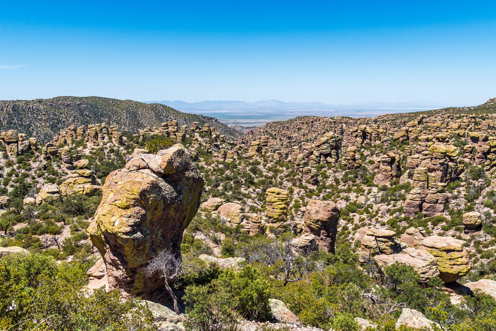
What Chiricahua protects is a landscape like no other. About 27 million years ago, a volcanic eruption laid down a thick layer of ash that hardened into rhyolite. Erosion then sculpted thousands of spires, pinnacles and balanced rocks that seem to defy gravity. The Chiricahua Apache called it the Land of Standing-Up Rocks; early visitors called it the Wonderland of Rocks. It is also a sky island: an isolated mountain above the desert, with its own stacked climates, from grassland to pine forest.
For us riders, the good news is that you see it by road. Bonita Canyon Drive is an eight-mile paved road that starts at the visitor center and climbs in switchbacks to Massai Point, 6,870 feet up — a climb of nearly 1,500 feet. Eight miles up, eight miles back: it is a dead end, and that is a gift, because you see the landscape from a different angle. At Massai Point, a half-mile trail loops around the viewpoint, with a 360-degree view over Rhyolite, Echo and Sarah Deming canyons. The 24-foot limit past the visitor center does not apply to a motorcycle.
To get there, leave I-10 at Willcox, follow Highway 186 south for 32 miles, then Highway 181 for 4 miles to the entrance. Count on about 36 miles from Willcox, and two hours from Tucson. One thing to plan for: there is no gas in the park. The nearest stations are in Willcox and Sunizona, some thirty miles away. Fill up before you turn onto Highway 186. And download your maps offline: cell service is practically nonexistent in the park.
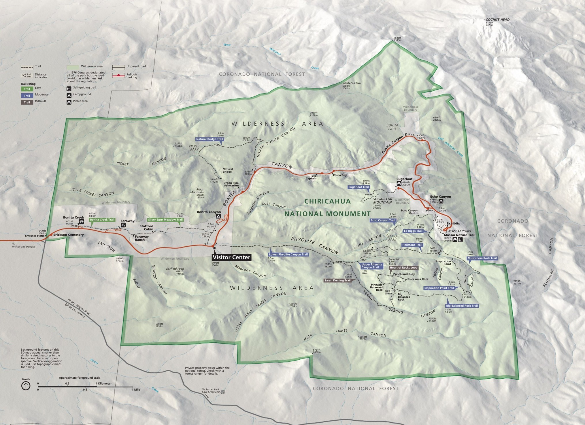
If you get off the bike, the Echo Canyon Loop, 3.3 miles, is the hike to do: it runs through the heart of the formations, between rhyolite walls and balanced rocks. Strong hikers can push on to the Heart of Rocks, about 7.3 miles round trip, to see the most famous formations, including Big Balanced Rock.
The best time to ride here is spring and fall, when temperatures are mild. In summer, the heat is crushing in the lowlands and monsoon storms break in the afternoon. In winter, it can snow at altitude and the road can close temporarily. The park grounds are open 24 hours a day, the visitor center from 8:30 a.m. to 4:30 p.m. And here is the detail that makes you smile: entry is free — no entrance fee, no parking fee, no pass to buy. Camping at Bonita Canyon is separate: you need a reservation and you pay for the night. With about 70,400 visitors in 2025, Chiricahua is still a quiet park — but the new title is bound to draw a crowd. Now is the time to go.
Let us be honest: on the ground, nothing changed on October 20. The same rocks, the same road, the same boundaries. What changed is the name on the map and the attention of the whole world. A brand-new national park, free to enter, with a mountain road running into the middle of a forest of stone: that is worth the detour. So, would you put Chiricahua on your American Southwest itinerary? Tell us in the comments. And for more motorcycle travel ideas, voyagemotoquebec.com.
Photos
Main photo: the rhyolite spires of Chiricahua. Photo: dconvertini, CC BY-SA 2.0, via Wikimedia Commons.
Sources
- National Park Service, news release: “Chiricahua National Monument Becomes America’s Newest National Park”
- National Park Service, entrance fees (Chiricahua)
- National Park Service, directions and access (Chiricahua)
- National Park Service, park maps (Chiricahua)
- EarthSky, “Chiricahua National Park: America’s 64th national park”
- Wikipedia, “Chiricahua National Park”
- Lonely Planet, “A Guide to Chiricahua, the USA’s Newest National Park”
- Cruise America, “Everything to Know About Chiricahua National Park (Newest US National Park)”